Fraser River
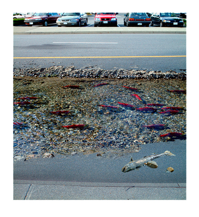
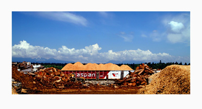
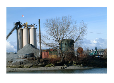
Images in this series were derived from selected photographs taken along the North and the South arms of the Fraser River. The images speak to the changing topographies and culture of a region that, for generations, was shaped by resource-economies – fishing, logging and shipping. In an increasingly “post-industrial” national economy, the fisheries, among other resources, are threatened by mismanagement and outmoded notions of entitlement.
Not unlike Zeigler’s earlier prints, photographic collages, and montages, many of these and other works done since the beginning of the 2000s are digitally layered and extensively drawn into, thereby continuing to call into doubt the historically assigned objectively of the photograph, and Fact and Fiction as mutually exclusive categories.
The Fraser River is one of the largest Pacific drainages in North America; flowing from the top of Mount Robson, on the Western border of Alberta, the river traverses the width of British Columbia –the North, Middle and South arms flowing through the Greater Vancouver Regional District before emptying into the Pacific Ocean.
 2. Parking Lot, Metro Vancouver, BC , 108 x 118.1 cm (42.5 x 46.5”), digital archival pigment print, 2003.
 4. The Chip Barge: North Arm of the Fraser River as viewed from Iona Island, Richmond, BC , 58.4 x 104.1 cm (23” x 41”), digital archival pigment print, 2003.
 5. View of Point Grey from Iona Island , Richmond, BC , 62.2 x 99.7 cm (24.5 x 39.25”), digital archival pigment print, 2003-06 .
 6. Concrete Factory, South Arm of the Fraser, Vancouver, BC, 111.8 x 153.2 (44 x 60.3”), digital archival pigment print, date 2004-06.